The December 2025 national timetable change had been described as ‘the biggest timetable change in more than a decade‘, and for train operator Northern, it meant some wholesale changes to its network in the North East.
When Northern’s new network map launched in the summer of 2025, we received plenty of feedback – 99% of it positive (thank you!), but also a range of suggestions about how to improve some things (thank you equally!).
We’ve taken that feedback on board and made some pretty big changes in the latest version.
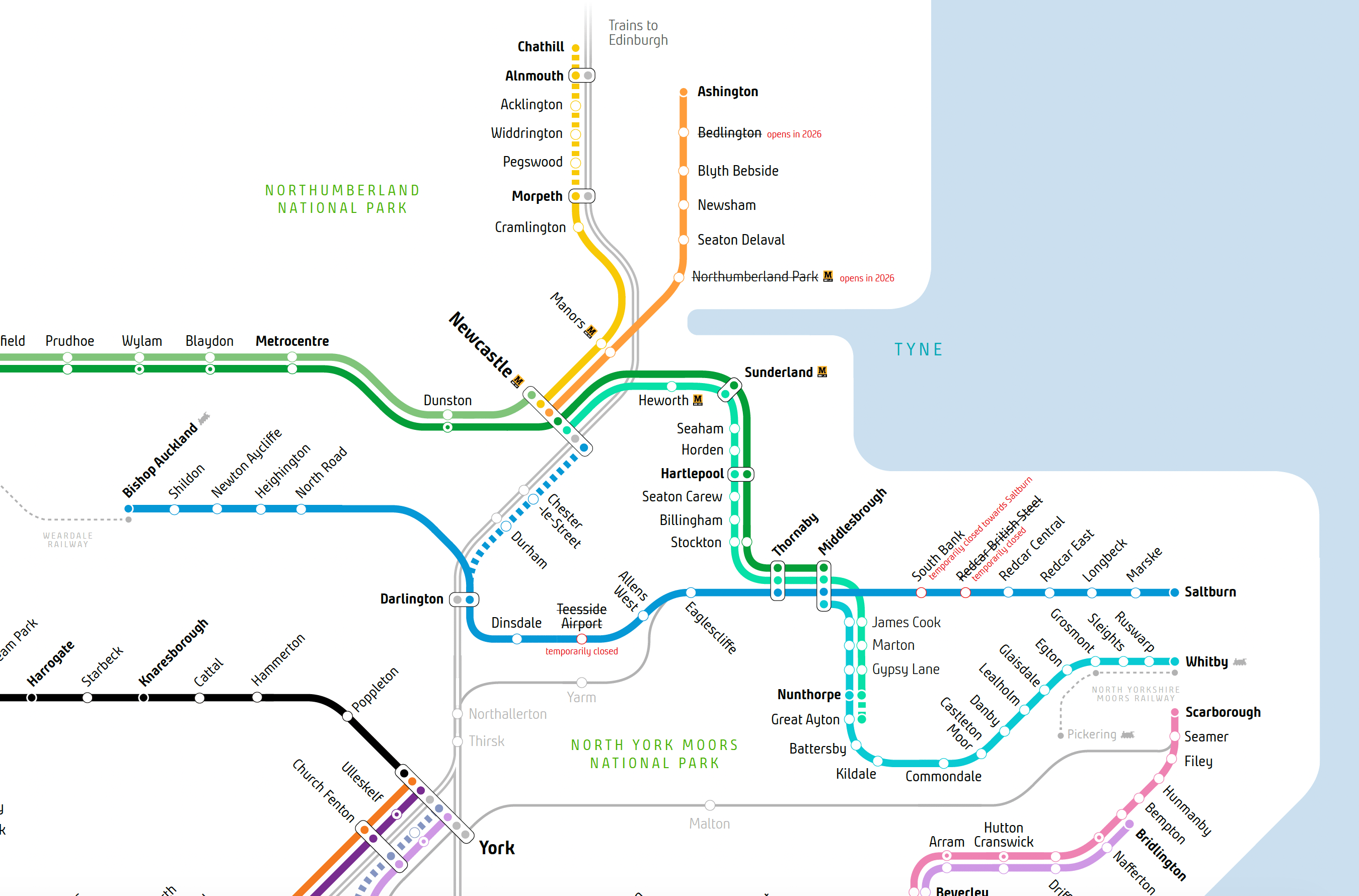
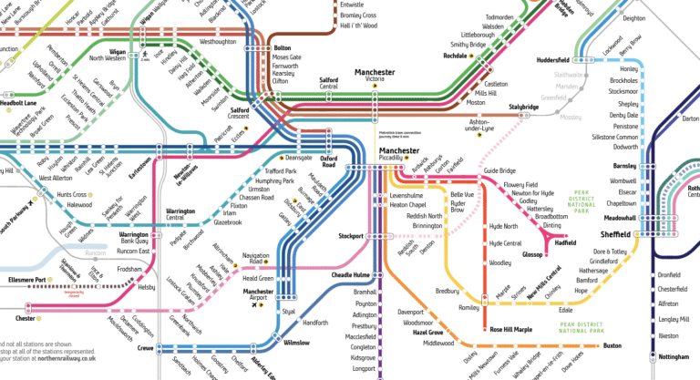
The North East has been completely redrawn
Previously, most of Northern’s services ran ‘across’ Newcastle, with service groups passing through the city’s main station. From 14 December, that changed – most services are now split at Newcastle, forming distinct service groups of their own.
Carlisle-Middlesbrough is the exception, passing through Newcastle after coming across from the Tyne Valley line, and dropping down the Durham Coast line via Hartlepool to Middlesbrough.
New colours have been given to most of the lines in this area to help differentiate them from other nearby service groups.
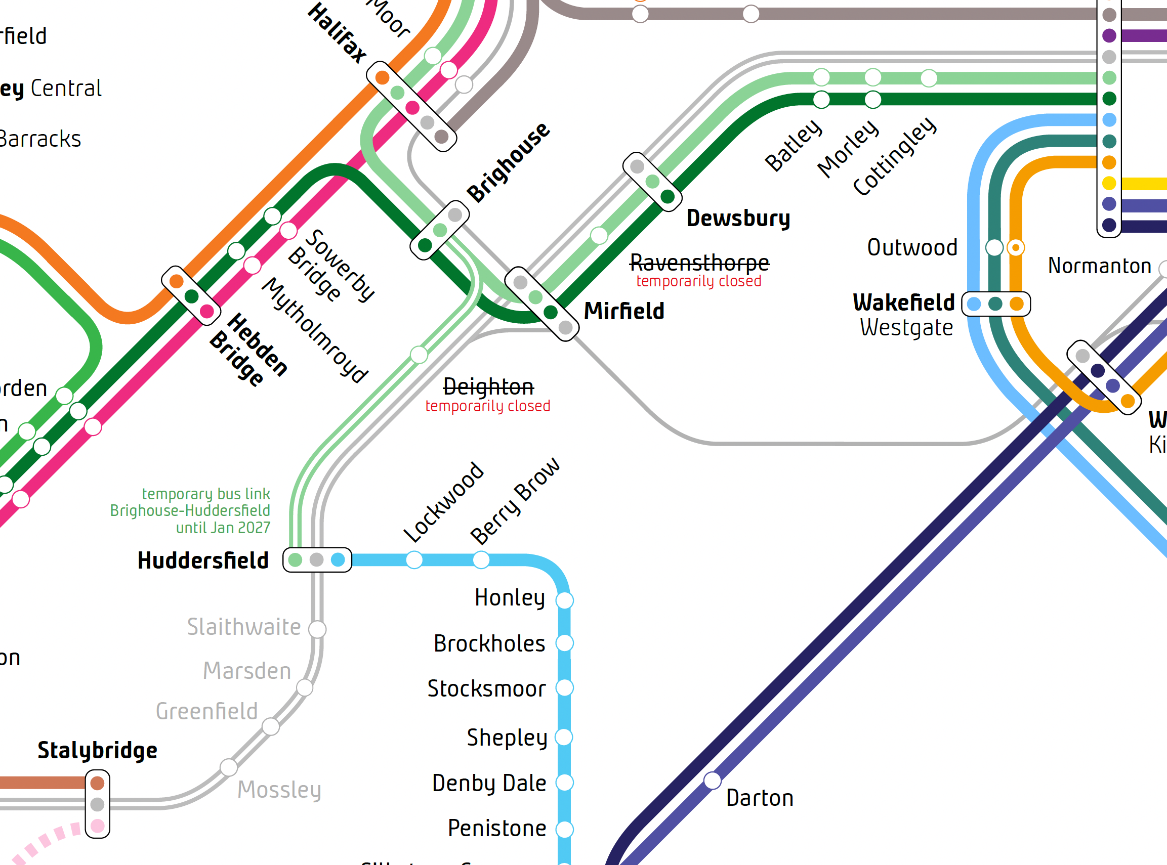
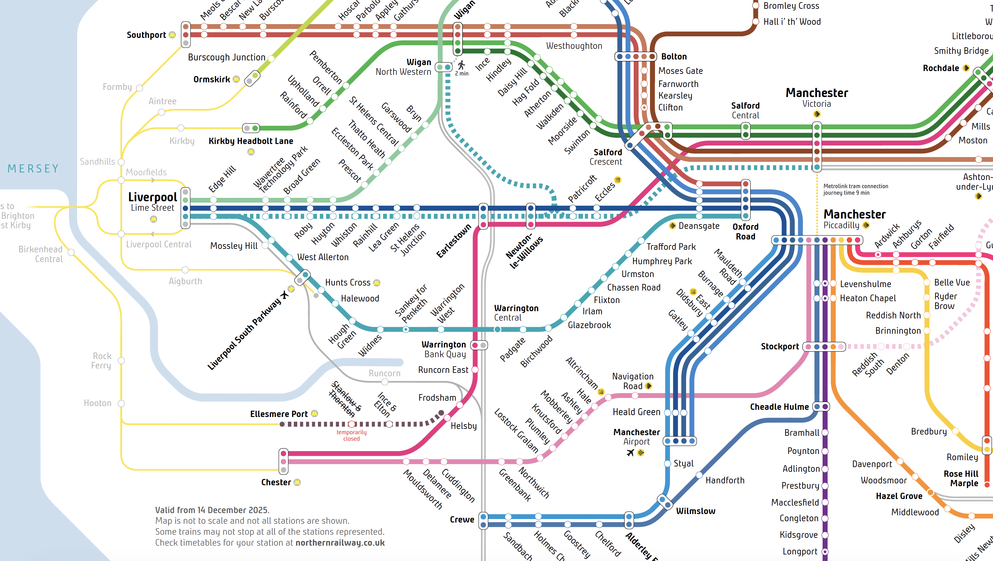
Other operator’s services are now better represented
One of the biggest areas of feedback we received was about how other train operator’s services were represented. Whilst this map is designed to reflect where Northern’s trains go, it’s important to show where connection exist, and in some cases, quicker routes (for example, from Liverpool to Chester or Crewe via Runcorn).
Changes from the first version of the map include:
- The TransPennine Express route between Manchester, Huddersfield, Leeds, York and Newcastle has been ‘upgraded’ with thicker lines and is now fully represented
- The TPE route via Normanton and Castleford is also now represented, and the area around Wakefield/Castleford and Leeds has been redrawn
- Grand Central’s route from Bradford, via Mirfield and Wakefield is now represented
- Added the ‘Halton Curve’ to show Transport for Wales connections between Liverpool and Chester
Merseyrail’s network has also been better represented and picked out in yellow, to help separate this distinct ‘closed’ network from surrounding services.
Other changes
Some updates have been made to better reflect service patterns between Manchester Airport, Preston, Lancaster and Barrow-in-Furness on the Furness and Cumbrian Coast lines.
A new service has also been added between Leeds and Sheffield, with the addition of a new and long-awaited ‘fast’ Northern train between the two cities which started in December.
What’s next?
Well, very shortly we’ll be releasing a draft of our promised ‘all-TOC / Great British Railways concept’ map, which will show Northern’s services integrated with the other operators in the North of England.
It’ll be heavily based on the Northern map, but has required some extensive redrawing, for reasons that will become fairly obvious when you see the work.
As ever, feel free to get in touch if you have any feedback, comments, questions.