A direct commission from Northumberland County Council to design an active travel map for Bedlington station — making bus connections and cycling routes legible and inviting, to shift the default journey habit away from the car and towards sustainable travel.
01
The challenge
Bedlington station sits at the edge of a town that, like many in the North East, has grown accustomed to the car as the default means of getting around. Despite being served by bus connections and lying within reasonable cycling distance for much of the local population, that information existed nowhere in a form passengers could actually use at the point of making a travel decision.
Northumberland County Council needed a piece of communication design that could do two things simultaneously: inform and persuade. Showing routes is the baseline — but the real task was presenting walking, cycling, and bus travel as credible, appealing choices rather than afterthoughts.
“The absence of a map isn’t neutral. When bus and cycling connections to the rail network aren’t shown, the car fills the gap by default.”
The project also needed to feel at home in a station environment — visually confident enough to hold attention alongside existing signage, while remaining clear and uncluttered for passengers in motion.
02
The approach
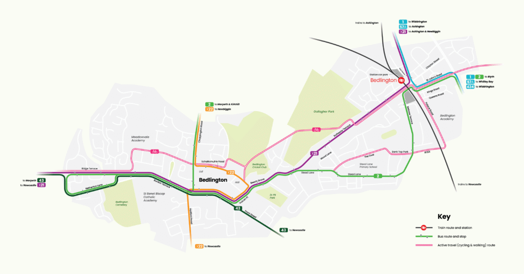
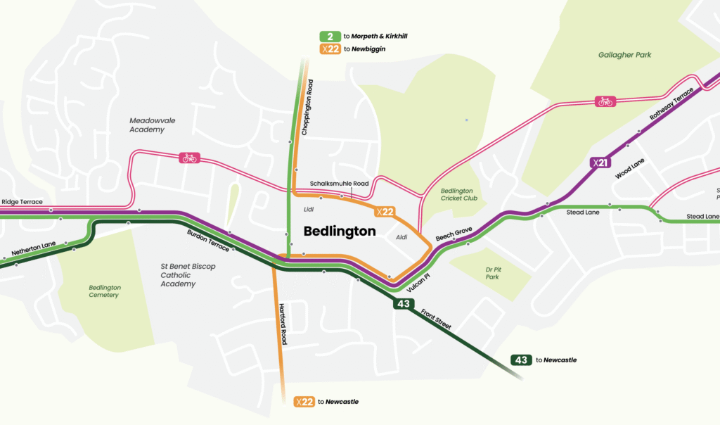
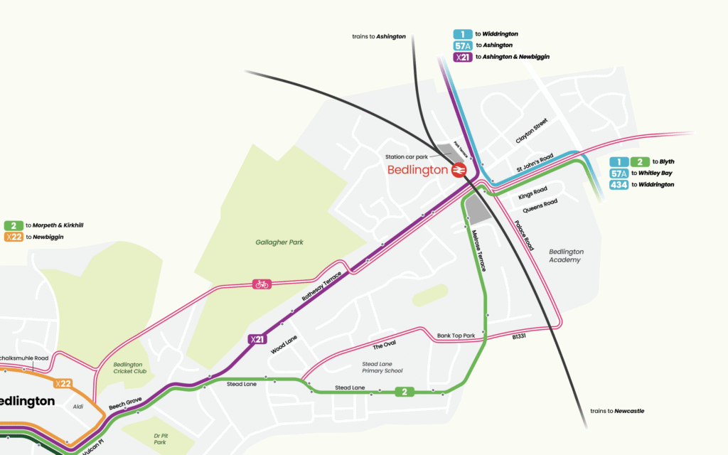
The map was designed around a single organising principle: the station as destination. Rather than presenting a neutral geographic overview, every element was oriented toward helping someone answer the question — “can I get to the station without driving?” The answer needed to be immediately, visually obvious.
Bus routes and cycling routes were given distinct visual identities within a shared colour and typographic system — different enough to read as separate modes, coherent enough to feel like a single, designed piece of information. Geographic accuracy was balanced against legibility, with route simplification applied where it helped rather than hindered wayfinding.
01
Active travel map — bus and cycling routes to Bedlington station
02
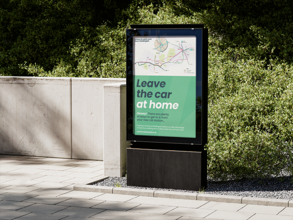
Bespoke station poster — print-ready, designed for platform display
03
Visual hierarchy system distinguishing bus, cycle, and walking modes
04
Typography, colour and layout carefully considered to aid visual clarity
03
The outcome
The active travel map and station poster were delivered as a coordinated pair — two formats, one consistent message. Together they represent the kind of infrastructure-level communication that active travel policy often lacks: design that is legible, credible, and present at the moment a passenger decides how to travel.
“Behaviour change in transport starts with information. This project gave Bedlington something it never had — a clear, well-designed case for leaving the car at home.”
For Northumberland County Council, the work sets a replicable template for other stations across the authority’s area. The design approach — station-centred, multi-modal, environment-aware — can be adapted to any comparable location without starting from scratch.
This project is characteristic of what Transport Designed does: working at the intersection of transport policy and communications design to produce outputs that are both strategically coherent and visually resolved.