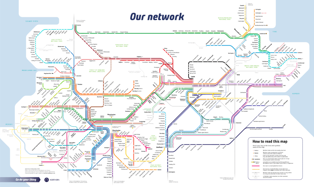
Northern’s new network map
Find out how Transport Designed redesigned Northern’s network map with clarity, consistency and connections in mind
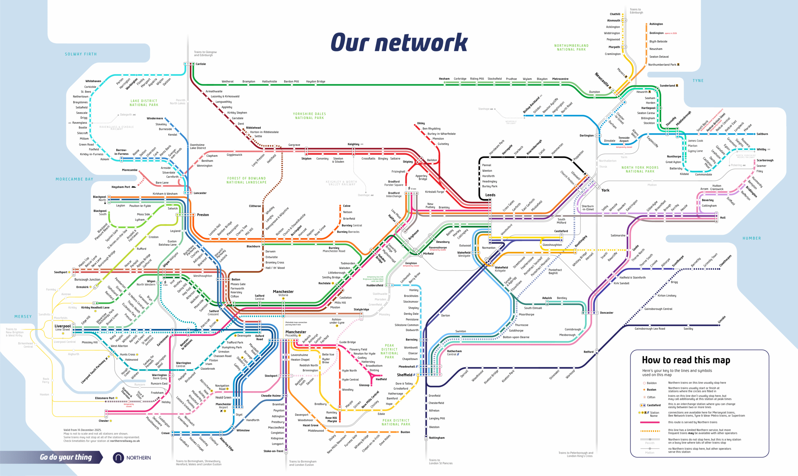
Find out how Transport Designed redesigned Northern’s network map with clarity, consistency and connections in mind
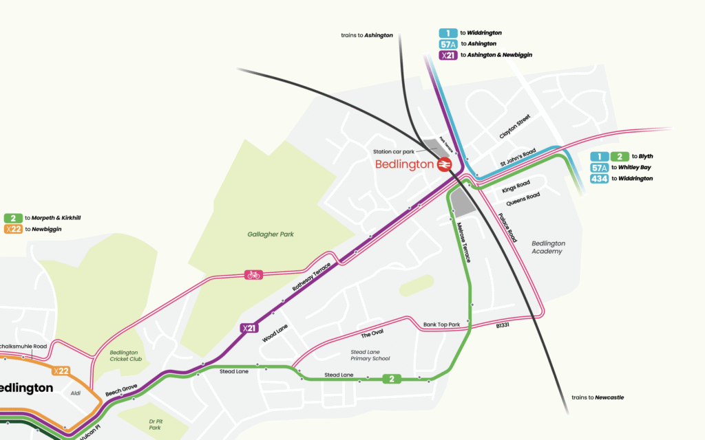
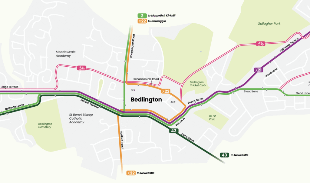
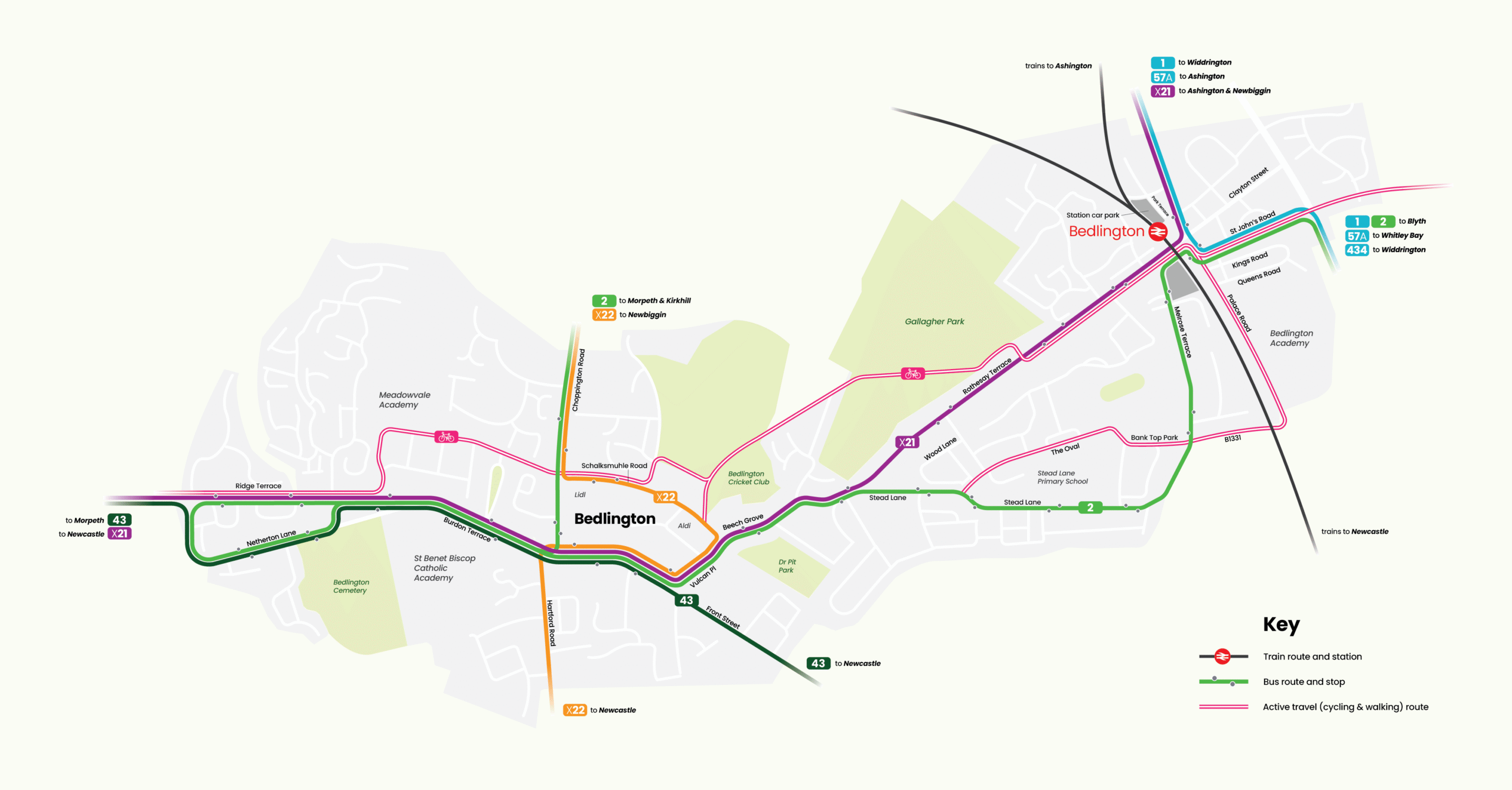
A direct commission from Northumberland County Council to design an active travel map for Bedlington station — making bus connections and cycling routes legible and inviting, to shift the default journey habit away from the car and towards sustainable travel
By continuing to enjoy our content, you agree to the use of cookies on our site. Find out more
The cookie settings on this website are set to "allow cookies" to give you the best browsing experience possible. If you continue to use this website without changing your cookie settings or you click "Accept" below then you are consenting to this.