Select Page

Check out these hand drawn maps of London by illustrator Jenni Sparks

Check out these hand drawn maps of London by illustrator Jenni Sparks

Are you a fan of beautiful maps and intricate illustration? You’re gonna LOVE this.

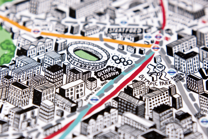
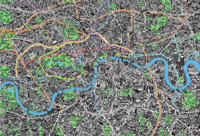
Illustrator and map-maker Jenni Sparks has created this beautifully detailed hand-drawn map of inner-city and Central London, complete with public transport picked out.

Wonderfully isometric in design, Jenni’s map highlights the meandering paths of Tube and heavy rail lines, and has been created with the intention of providing a guide for tourists which subverts the traditional (and often badly designed) idea of what a tourist map should look like.

The map features all of the major tourist spots, including beautifully detailed representations of the Shard, Olympic Park, the Gherkin and Earl’s Court – and if you look closely enough, you might even spot some familiar characters…

Jenni's map of London features many familiar sights...

Jenni Sparks' incredible London map.

Jenni’s work is available to view on her website, and you can buy prints of these incredible illustrations at Evermade.

All images are copyright – Jenni Sparks.

About The Author

Matt Harrison

Matt Harrison MCIM is a communications and marketing expert with over 12 years' experience, specialising in public transport. As Founder of Transport Designed, Matt is on a mission to celebrate and work with the most forward-thinking and innovative transport brands on the planet.

Leave a reply

Your email address will not be published.

Pin It on Pinterest

By continuing to enjoy our content, you agree to the use of cookies on our site. Find out more

The cookie settings on this website are set to "allow cookies" to give you the best browsing experience possible. If you continue to use this website without changing your cookie settings or you click "Accept" below then you are consenting to this.

Close