Architect and mapmaker Jug Cerovic has presented a stunning alternative to a British rail operator’s network map.
NS-owned East Midlands Railway took over the East Midlands franchise from long-term incumbent Stagecoach back in August 2019. At the time, we reported on the operator’s new aubergine-based livery and brand, which replaced the much-loved ‘swoops’ identity of the former operator East Midlands Trains. The new operator of the East Midlands franchise introduced three brands for their newly-minted network: EMR Intercity, for fast trains to London; EMR Regional, for slower trains connecting towns and cities across the Midlands; and EMR Electrics, for their new electric services between London, Luton and Corby.
Since EMR launched, Jug Cerovic has recreated their original, rather minimalist network map, reimagining EMR’s network by placing less of a focus on geographical locations, and more emphasis on legibility – and beauty.
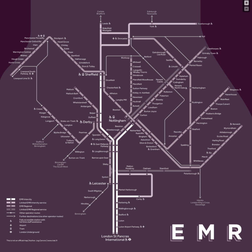
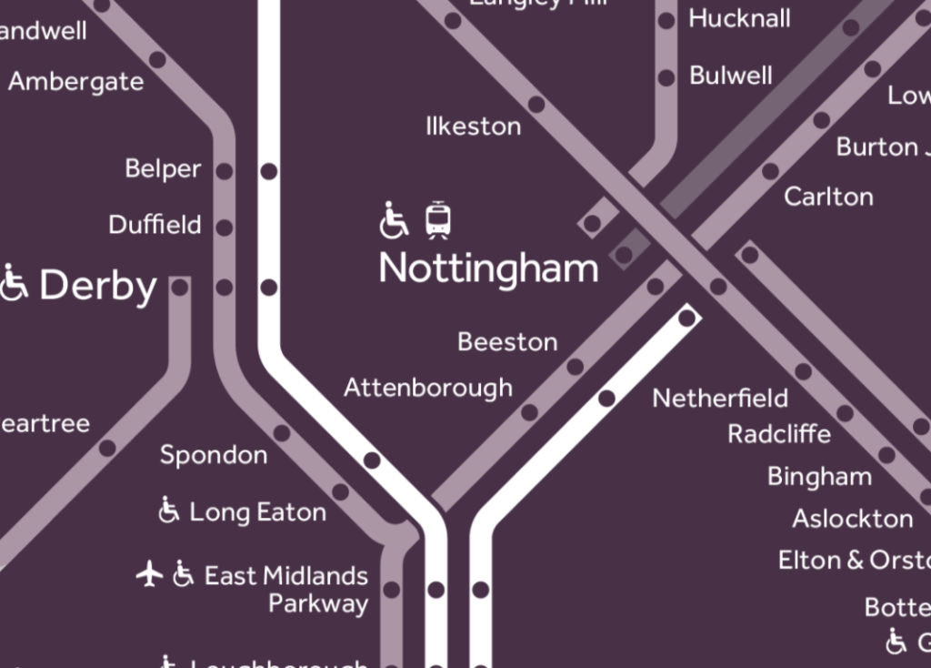
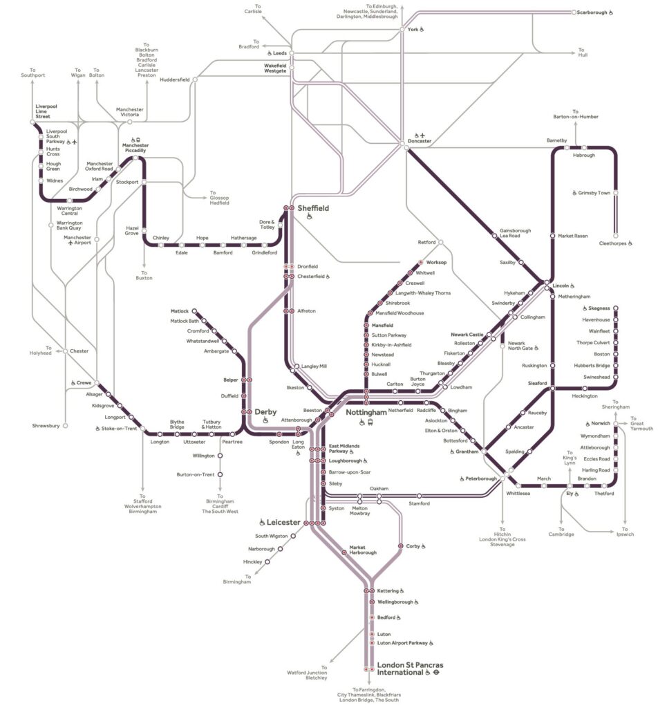
Gone is the wad of white space and spaghetti-like mass of confusing, criss-crossing lines present on EMR’s actual network map, to be replaced with a uniform set of lines where contrasting shades of aubergine and white denote the fast Intercity and Regional services. As per the original, other operator’s routes are still represented, but with much less emphasis – the focus here is on representing EMR’s network and connections, rather than trying to place the operator’s services within their own wider geographical network.
Centred on Nottingham, the heart of the EMR network, Cerovic’s map also follows a uniform set of angles, which work particularly well given the geography of the network. EMR’s ‘actual’ map is far more concerned with the cartography of its network, attempting to place its services in context around their local areas. Few stations are mentioned outside of the EMR network, with only principal stations picked out to aid recognition. Cerovic’s map does away with these almost entirely – presenting almost exclusively only the stations which the operator actually serves.
Over to you
What do you think about the two sets of cartography? Are you on board with Jug Cerovic’s redesign, or do you prefer the original from EMR? Let us know in the comments below.
You can find out more about Jug Cerovic’s work, and more about his INAT wayfinding and mapping consultancy here. Or plan your next journey with East Midlands Railway here.


5 Responses
4
Impressive for it’s cartography, but I suspect the multiple shades of diluted aubergine would be a nightmare for anyone with less than 20/20 vision or colour recognition. But then, do customers really know (or care) whose train they are travelling on anyway? In my experience, knowing there is a train available for connections is far more important than whose train it actually is.
Yes, very valid points. EMR’s ‘actual’ map must surely come up tops in terms of legibility for those with visual impairments. It may become a moot point regarding customers knowing or caring ‘whose’ train they’re on – it matters less and less, with the government effectively renationalising the railways. Interesting times to come, I think.
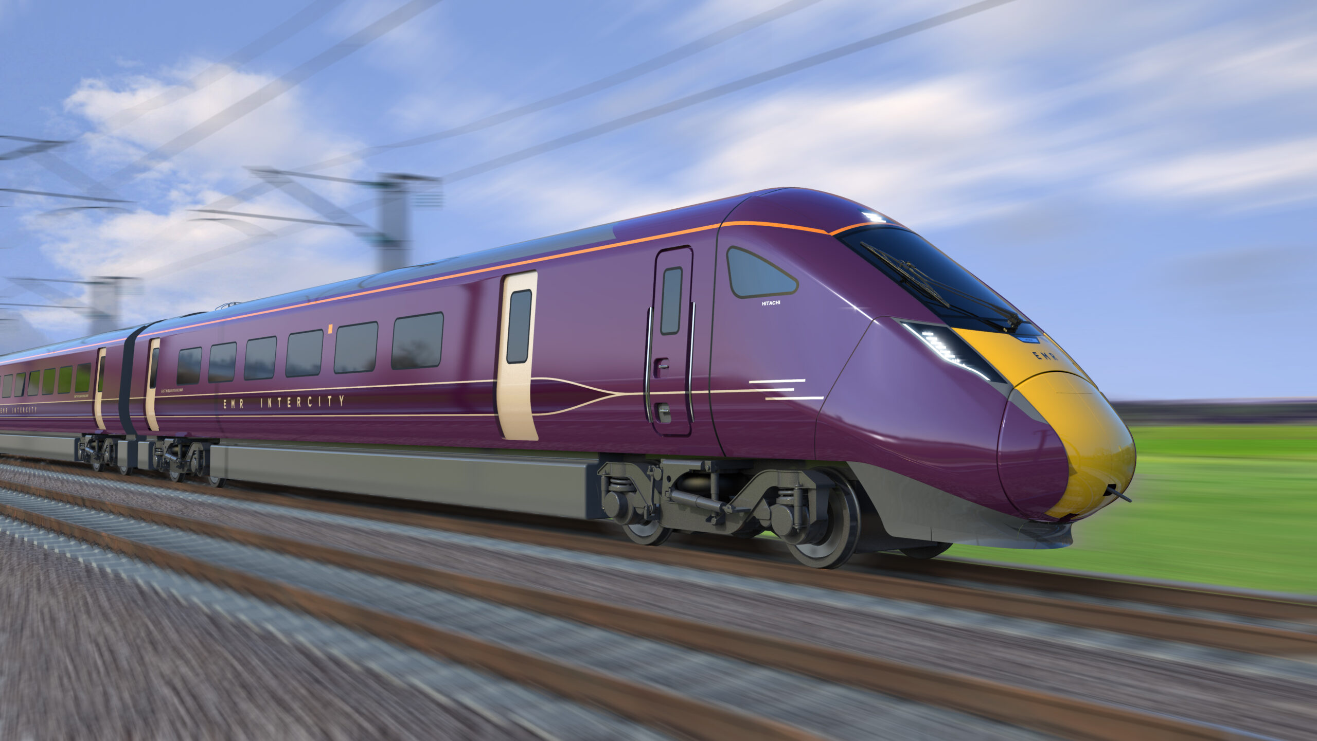
What routes will the Class 810 Aurora AT300s will operate on. Mainly on London St. Pancras-Nottingham, Derby, Sheffield, Leicester, Leeds, Matlock, Huddersfield, York, Scarborough, Lincoln and other main line services. With the Class 360 Desiros cascaded from Greater Anglia to mainly operate on London St. Pancras-Kettering and Corby. And will East Midlands Railway retain the Class 180 Adelante DMU and Class 222 Meridian DEMU units. Or will they be transferred to other rail operators (ie-Crosscountry, Transport for Wales, Great Western Railway, ScotRail, South Western Railway, Northern or Transpennine Express).
The layout of the “revised” design is much better, but the coloration is so wrong!
All maps of this sort should be on a white background for clarity.